Public-domain ebook
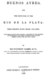
Buenos Ayres and the Provinces of the Rio de La Plata Their Present State, Trade, and Debt
Language: en1,096 downloads on Project Gutenberg
Subjects
In: History - Other
Public-domain ebook sourced from Project Gutenberg #47169.
Public-domain ebook
Language: en1,096 downloads on Project Gutenberg
Subjects
In: History - Other
Public-domain ebook sourced from Project Gutenberg #47169.
This work is a scholarly survey of the Argentine Republic and its surrounding territories in the early nineteenth century, presented by Sir Woodbine Parish as a concise companion to the massive documentary series being issued by Don Pedro de Angelis. The opening pages are occupied with a detailed inventory of the manuscripts, maps, and personal journals that Parish consulted, ranging from the diaries of Don Juan de la Piedra’s 1778 Patagonia expedition to the unpublished reports of Spanish frontier officers and the vivid accounts of English adventurer Luke Cresser. Parish explains how generous access to government archives, the generosity of local scholars, and a handful of private collectors enabled him to assemble a “brief and general sketch” of the region’s geography, trade, and fiscal conditions, while directing readers to the more extensive, Spanish‑language volumes for deeper study.
Written in a formal, eighteenth‑century travel‑report style, the narrative blends meticulous citation with occasional anecdotal episodes, reflecting the author’s background as a diplomat‑explorer. Its tone is earnest and descriptive rather than romantic, making it appealing to historians of South American colonial and post‑independence periods, geographers interested in early cartographic sources, and readers who enjoy dense primary‑source commentary on the formation of the Río de la Plata provinces.
The opening · free to read
Some few individuals were actuated by a different spirit, amongst whom I ought especially to name Dr. Segurola, the fellow-labourer with Dean Funes in his historical essay upon the provinces of La Plata, whose valuable collection of MSS. (from which that work was principally compiled) was always accessible to his friends, and to whom I have to acknowledge my own obligations for leave to take copies of many an interesting paper. Others, also, whom I do not name, will I trust not the less accept my thanks for the facilities they afforded me for obtaining such information as I required. The government, I must say, was always liberal, in giving me access to the old archives, and in permitting me to transcribe documents[1] which I could not have obtained from other quarters.
With these facilities, and by purchase, I found myself, by the time I quitted South America, in possession of a considerable collection of MS. maps and of unedited papers respecting countries of which the greater part of the world is, I believe, in almost absolute ignorance.
Amongst the most interesting perhaps of these I may mention--
The original Diaries of Don Juan de la Piedra, sent out from Spain, in 1778, to explore the coasts of Patagonia.
A series of papers drawn up by his successors the Viedmas, the founders of the settlements at San Julian and on the Rio Negro.
The original Journal of Don Basilio Villariño, who, in 1782, explored the great river Negro, from its mouth in lat. 41° to the foot of the Andes, within three days' journey of Valdivia, on the shores of the Pacific.
The Narrative, by Don Luis de la Cruz, of his Journey through the territory of the Indians and the unexplored parts of the Pampas, from Antuco, in the south of Chili, to Buenos Ayres, in 1806.
The Diary of Don Pedro Garcia's Expedition to the Salinas, in 1810, given me by my most estimable friend, his son, Don Manuel.
Together with a variety of other unpublished accounts of the Indian territories south of Buenos Ayres, principally collected by order of that government, with a view to the extension of their frontiers.
The substance of these papers, all which relate to the southern and least known parts of the New Continent, will be found in Chapters VII., VIII., and IX.
Respecting the eastern or Littorine provinces of the Republic, as I have ventured to call them, the most valuable data existing are, first, those collected by the Jesuits, and next, the various reports and memoirs drawn up by the officers employed to fix the boundaries under the treaties between Spain and Portugal of 1750 and 1777. The especial qualifications of the individuals, particularly of those employed in the last case, the length of time spent upon the service (more than twenty years), and the enormous expenses incurred by Spain in the endeavour to complete that survey, led to a large accumulation of invaluable geographical data respecting extensive ranges of country never before properly examined, much less described.
Nor were the labours of the officers in question confined to the frontiers. They fixed, as I have stated in Chapter VIII., all the principal points in the province of Buenos Ayres, made surveys of the great rivers Paranã and Uruguay, and of their most important tributaries; and drew up many notices of great interest respecting the countries bordering upon the higher parts of the Paraguay, which the pretensions of the Portuguese in that direction rendered it requisite for them to explore with more than ordinary care and attention[2].
M. Walckenaer's publication at Paris, in 1809, of the Travels of Don Felix Azara, one of the King of Spain's commissioners on that service, contains a general review of the labours of those officers, and is perhaps the best work in print upon the countries which it describes; still it can only be regarded as a very imperfect sketch of the information collected by one of many able men employed upon that particular service.
Another of the commissioners, Don Diego Alvear, drew up an historical and geographical work upon the provinces of Paraguay and the Missions, quite equal in interest, if not more so, than that by Azara, for a MS. copy of which I have to thank his son, the present General Alvear.
Colonel Cabrer, the only surviving officer of all those employed on this important survey, was living during the time I was at Buenos Ayres, and for many years had, to my knowledge, been engaged in drawing up an elaborate account of the whole progress of the survey from first to last; in his possession I saw a complete set of all the beautiful maps executed by the Spanish officers, the originals of which are deposited at Madrid. He is lately dead, and I understand that the authorities of Buenos Ayres have been in treaty for the purchase of his papers, which will be of the greatest importance, not only to them, but to the governments of the Banda Oriental, of Paraguay, and of Bolivia, whenever the time comes, as it must ere long, for definitively fixing their respective boundaries with Brazil. I considered myself fortunate in obtaining copies of several detached portions of these surveys, and particularly of an original map, drawn from them by Colonel Cabrer himself for General Alvear, when commanding-in-chief in the Banda Oriental in 1827.
There is no doubt that, so far as the Spanish frontiers extended, these maps are the best existing data respecting the countries which they delineate: on the other hand, we must look to the Portuguese authorities for materials for the adjoining provinces of Brazil. The most perfect map of that part of the continent perhaps ever made was drawn at Rio de Janeiro in 1827, for the use of the Marquis of Barbacena, when appointed to command the Emperor's army in the war with Buenos Ayres, and was taken with his baggage at the battle of Ituzaingo, and afterwards given to me. It comprises, on a large scale, all the country lying east of the Uruguay, from the Island of St. Catharine's to the River Plate. On my return to England I placed it in the hands of Mr. John Arrowsmith, with the rest of my geographical materials.
As regards the greater part of the interior provinces west of the Paraguay, the information obtainable is very imperfect; indeed of some vast portions of those regions, it may be said that nothing but the general courses of the principal rivers is as yet known. The immense tract called the Gran-Chaco is still in possession of aboriginal tribes, and other extensive districts are inhabited by people who, though of a different race, seem little beyond them in civilization.
It was not the policy of Spain to take the trouble of accurately examining her colonial possessions, except when obliged to do so in furtherance of measures of self-defence, or in the expectation of some profitable return in the precious metals, the primary objects of her solicitude: and, but that the high road from Potosi to Buenos Ayres ran through them, I believe in Europe we should hardly have known, till recently, even the names of the capital towns of the intermediate provinces: it is only since their independence that they have brought themselves into notice, and that any information has been acquired of the nature and importance of their native products.
When I arrived at Buenos Ayres in 1824, in hopes of obtaining the best existing accounts of their statistics, I addressed myself to the governors themselves; and I have every reason to believe, under the circumstances, that they were desirous to meet my wishes. I received from them all the most civil assurances to that effect; but, excepting from the Entre Rios, Cordova, La Rioja, and Salta, I found the authorities themselves utterly unable to communicate anything of a definite or satisfactory nature; and, although they promised to set to work to collect what I asked for, I soon found they had most of them other matters on hand which had more urgent calls on their attention.
Of the information which I did so obtain, the most complete by far was from General Arenales, the Governor of Salta, who not only forwarded to me an interesting report upon the extent and various productions of that province, but, what I less expected, a very fair map of it, drawn by his own son Colonel Arenales; an individual who has since distinguished himself amongst his countrymen by the publication of a work[3] wherein he has with great pains collected all the information he could obtain to elucidate the geography and capabilities of a province which nature seems to have destined to be one of the most important of the Argentine Republic. Were his good example followed by equally intelligent individuals in other parts of the interior, the natives, as well as foreigners, would be greatly assisted in learning not only what are the productions of their own country, but in what manner they might be rendered available in furtherance of its prosperity.
He has done his duty, and rendered a service to his country, by pointing out the great importance of the possibility, now proved beyond a doubt, of navigating the river Vermejo throughout its whole course, from Oran in the heart of the continent to its junction with the Paranã, and thence to the ocean.
Mr. Arrowsmith has adopted his delineation of the course of that river, as laid down from the diary of Cornejo, who descended it in 1790. Soria, who came down it in 1826, was deprived of all his papers in Paraguay; and although, on reaching Buenos Ayres, five years afterwards, he not only published a short account of his voyage, but a map also to illustrate it, being entirely from memory, it is little to be depended upon; neither is it reconcilable with the distance from Oran to the Paraguay, as estimated either by himself or Cornejo.
Of Soria's voyage, besides his own account, I had a much more full and curious narrative from an Englishman of the name of Luke Cresser, who was one of the party, and whose personal adventures would form an entertaining episode in any history of that enterprise. He was a Yorkshireman by birth, and originally a watchmaker, in which trade, after making a little money at Buenos Ayres, he had found his way into the upper provinces, and had finally become a grower of tobacco in the province of Oran. Having a large stock on hand about the time Soria was about to descend the Vermejo, he was induced to ship it, and to embark with him for Buenos Ayres. He was of the greatest service to the party on the voyage, and was severely wounded, in the skirmish they had with the Indians, by an arrow, which pierced his arm, and occasioned him much and long suffering afterwards. On reaching the Paraguay, had Soria listened to his urgent advice and entreaties, he never would have placed himself in Dr. Francia's power; for which, indeed, there does not appear to have been the slightest necessity. When the vessel was detained by that despot's orders, Cresser, like the rest, was stripped of all he possessed; and, after much suffering, was sent to Villa Real,--a wretched establishment on the Paraguay, about 150 miles above Assumption.
The book keeps going
Reading is free forever. Sign up and watch scenes appear while you read.



Scenes Storieta drew for other classics.
New illustrated classics
Once or twice a month: the latest books to get full character casts, scene art, and free comic editions. No account needed.