Public-domain ebook
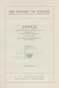
Japan: From the Japanese Government History
Language: en2,850 downloads on Project Gutenberg
Subjects
In: Mythology, Legends & Folklore·History - Other
Public-domain ebook sourced from Project Gutenberg #45645.
Public-domain ebook
Language: en2,850 downloads on Project Gutenberg
Subjects
In: Mythology, Legends & Folklore·History - Other
Public-domain ebook sourced from Project Gutenberg #45645.
The work is a revised edition of a government‑commissioned history of Japan, originally compiled in 1893 for the Imperial Japanese Commission at the 1893 World’s Columbian Exposition. The opening pages acknowledge a long list of scholarly advisers and explain that the present editor has updated the original “History of the Empire of Japan” by correcting outdated data, omitting trivial details, and smoothing the narrative, while preserving the overall structure. The fourth part is the editor’s own contribution, intended to give a popular yet accurate account of developments that have occurred since the first edition, including territorial gains up to 1905. The introductory material then launches into a detailed geographic description of the empire, its islands, coastlines, mountains, rivers, climate, flora, and fauna, providing a factual foundation for the historical narrative that follows.
The prose reflects the scholarly yet accessible style of early‑20th‑century academic publishing, with a tone that is both descriptive and reverent. It combines precise measurements, such as latitudinal extents and river lengths, with broader observations about climate zones and natural resources. Readers who appreciate a methodical, fact‑rich overview of Japan’s physical setting and its evolution up to the Russo‑Japanese War will find this volume rewarding, especially those interested in the period’s diplomatic and educational contexts or in comparative studies of nation‑building.
The opening · free to read
The present revised edition of the "History of the Empire of Japan" (compiled, in 1893, for the Imperial Japanese Commission of the World's Columbian Exposition at Chicago, by Messrs. K. Takatsu, S. Mikami, M. Isoda, and others, and published in Tōkyō by order of the Department of Education) is not intended to supersede the original edition, the high qualities of which are, on the contrary, recommended to all students of Japanese history. That work admirably represents what might be termed the orthodox view of the national history, and is free alike from the unscientific method of the more conservative historian, and from the superficial speculations of the more radical, but not more scientific, student. Were the present editor to write an original work on Japanese history, however, he would, it is unnecessary to say, change the entire manner of presentation in order to make it accord with his own conception of the subject-matter. In this revision, he has not changed the general order of the original work, but has merely corrected a few data which are obviously out of date, omitted those minor facts which may well be dispensed with, and made the general narrative somewhat smoother than it was.
The fourth part is, however, the editor's own work. The primary aim in this division of the volume has been to supply a popular and accurate account of certain phases of the national progress that has taken place since the "History of the Empire" was prepared a dozen years ago. The substance of chapter XVIII has appeared among the new chapters supplied by the editor to the new edition of Brinkley's (edit.) "Japan," (J. B. Millet Co., Boston, 1905), and has been inserted here with the permission of those publishers.
The Empire of Japan consists to-day of a group of islands marshaled in the northwest corner of the Pacific Ocean, off the eastern coast of the Asiatic continent. These islands--including Formosa and the Pescadores ceded by China in 1895, and the southern half of Sakhalin, acquired from Russia in 1905--lie between the parallels of 50° 56' and 21° 48' north latitude, and the longitude of their extreme eastern and western points are 156° 32' and 119° 20', respectively, east of Greenwich. The empire thus covers 29° 8' of latitude and 37° 12' of longitude. On the east it faces the Pacific; on the southwest it looks across the waters of the China Sea to the mainland of China; on the northwest the Sea of Japan and Gulf of Tartary separate it from Korea and Siberia. The fiftieth parallel divides the Japanese half of Sakhalin from the northern or Russian half, and the Kurile Strait intercepts the Chishima or Kurile group of islands on the north from the Russian peninsula of Kamchatka.
The whole group includes five and one-half large islands and nearly six hundred islets. The large island lying in the center constitutes the mainland; the island directly to the north is Hokkaidō (Yezo or Ezo), and that to the south, Kiushū; on the southwest of the mainland and east of Kiushū is Shikoku; and stretching in a northwesterly direction from Hokkaidō are the Chishima or Kuriles, while the chain of the Riukiū (Loochoo) Archipelago leads to Formosa. Floating, as it were, in the Sea of Japan are the islets of Sado, Oki, and Tsushima, the last lying only about fifty miles from the southern coast of Korea. Scattered in the Pacific Ocean, at a distance of nearly 500 miles from the southwest coast of the mainland, lies the Ogasawara group (Bonins). To these must now be added the recently ceded southern half of the Island of Sakhalin.
Owing to the insular nature of the country, the area of the empire, exclusive of the half of Sakhalin, which is perhaps as much as 12,000 square miles, little exceeds 161,000 square miles, or slightly larger than the area of the British Isles. More than half of this superficies is comprised in the main island. The coastline of the fourteen larger islands and archipelagoes, again excepting Sakhalin, stretches to a length of 13,500 miles. Little indented, the coast along the Sea of Japan offers few bays or promontories; but the Pacific and the China Sea coasts are broken into innumerable capes and inlets, and abound in good harbors.
The country is mountainous, and has little flat land. Two systems of mountain chains extend north to south and east to west, each having numerous branches. The highlands of the empire are the two provinces of Shinano and Kai, situated in the center of the main island. At the boundary of Kai and Suruga stands Fujisan, or Mount Fuji, capped with perpetual snows, its summit rising to 12,300 feet above the sea level. Its position as the loftiest peak in the country has been lost by the acquisition of Formosa, which contains Mount Morrison, now called Mount Niitaka, the altitude of which is not less than 14,200 feet. The mountains of the main island are for the most part volcanic, the active volcanoes numbering 170, and the ranges that comprise them stretch across the extent of the country. Mines and mineral springs consequently abound. Frequency of earthquakes also results from the abundance of volcanoes. Minor shocks average from thirty or forty to several hundreds annually, and of severe shocks history shows that there have been some two or three in each century, entailing sometimes a frightful destruction of life and property.
From the general configuration of the country it follows that great rivers with long courses are few, but numerous streams of lesser magnitude traverse all parts of the empire, affording excellent facilities for drainage and irrigation. Many of the larger of these are even navigable. The Ishikari River in Hokkaidō, with a length of 407 miles, is the longest in the empire, followed by the Shinano, in the main island, about 240 miles long. Nor is the land richer in extensive plains than in great streams. Valleys lying deep in the bosoms of the hills, plateaus along the margins of the great rivers, gentle slopes at the foot of mountain ranges, or stretches by the seashore, are the only comparatively level places to be seen. The Ishikari Moor, bordering the Ishikari River in Hokkaidō, is perhaps the most extensive. Its soil is rich, and it abounds in timber and verdure. Other well-known plains in the north lie along the course of the Tokachi River and by the seashore at Kushiro and Nemuro. Passing to the main island, we find, in the northeasterly section, the Ōshū plateau, traversed by the Kitakami and Abukuma Rivers, and extending over the provinces of Rikuchū, Rikuzen, Iwashiro, and Iwaki. There, too, the soil is rich, and fruitful lands cover a wide area. In the central section the valley of the Tone River forms the Hasshū plain of the Kwantō, spreading into the four provinces of Musashi, Kōzuke, Hitachi, and Shimōsa. Thickly populated and highly fertile, this plain is the most extensive in the main island. Next in order of magnitude comes the valley of the Kiso River, forming a part of the provinces of Mino and Owari, and making one great cultivated field. The Echigo plain, along the lower waters of the Shinano River, is the most extensive of all the littoral plains of Japan. For the rest, very wide plains exist in Kinai, along the banks of the Yodo and Yamato Rivers; while in Shikoku, the most extensive flat-lands are found along the course of the Yoshino River, and in Kiushū the lands by the banks of the Chikugo down to the Ariyake seabeach give to the provinces of Chikugo and Hizen a broad area of irrigated fields.
The main island of Japan, being situated in the temperate zone, enjoys, for the most part, a medium degree of temperature. But the climate of the empire is much varied, owing to the elongated shape of the country, which extends over nearly thirty degrees of latitude, to the great differences of altitude that characterize the surface of the land, and also to the action of a warm and a cold current that flow past its shores. Thus, in the northern part of Hokkaidō and in the Chishima Islands the snow never disappears, the sea freezes in winter, and sleet and fogs prevail. On the other hand, in the southern district, as well as in the Riukiū and Ogasawara groups, the heat is very great, and neither snow nor ice is seen in winter. In the central parts, again, the temperature varies according to the elevation of the land, and the configuration of the mountains and seas. As for Formosa, it is partly situated within the tropical zone, and the two extremes of the entire island are recorded to be 96° and 41° Fahrenheit.
The warm ocean current, known as the Kuro-shiwo or Black Stream, from the deep somber color it displays in cloudy weather, rises from the distant Equator, and possesses an average temperature of 81° Fahrenheit in summer. Immediately after leaving the Equator it travels along the eastern coast of China, and thence passing northward, approaches the coast of Kiushū, where it bifurcates. The branch stream enters the Sea of Japan, and flows to the north; the principal stream passes by the southern coast of Shikoku and the main island, until it reaches the north of Cape Inubō in Shimōsa, where it again bifurcates, a branch turning northward, and the current itself traveling in a northeastern direction until it leaves the main island. In consequence, perhaps, of the heat received from this warm current, all the provinces of Kiushū, Shikoku, Sanyō-dō and Tōkai-dō seldom see snow. There is also a cold stream called the Oya-jiwo, of which the average summer temperature is as low as 37°. Its source is in the Sea of Okhotsk, whence it passes through the Kurile Islands, and flowing by Hokkaidō and the east coast of the northern section of the main island, reaches the neighborhood of Cape Inubō, where it disappears. Situated in a high degree of latitude, Hokkaidō and the northern part of the main island, being further exposed to the influence of this cold stream, have a severe climate. The snow lies there in masses for many days and the winter is long.
The rainfall is heavy in summer and light in winter. It is greatest along the coasts washed by the Pacific Ocean and the Sea of Japan, and least in the central portions of the country along the two coasts of the Inland Sea, as well as in the northern end of the main island. Hokkaidō has an average fall.
Rich soil, a genial climate, and a sufficient rainfall produce luxuriant vegetation. Cultivated fields and gardens succeed each other for wide areas. The extraordinary position of the islands stretching from north to south also adds greatly to the variety of vegetation. Thus in Kiushū and Shikoku are to be seen thick, verdant forests abounding in giant trees. Sugar-canes, tobacco, and cotton, find a soil congenial to their growth. The cocoa, the banyan tree, the banana and their congeners flourish in the Riukiū and Ogasawara Islands. In short, the general aspect is tropical. Passing thence to the central districts, great varieties of plant life are found. The pine (pinus densiflora and pinus massoniana), oak (quercus dentata), hi-no-ki (thuya obtusca), sugi (cryptomeria japonica), camphor and bamboo grow in the woods; while the mulberry, tea plant, lacquer tree, millet, the five cereals, vegetables, and various kinds of fruits are seen in the fields and gardens. Finally, even in the cold and little cultivated Hokkaidō, its fruitful soil and luxuriant vegetation invite agriculture.
The book keeps going
Reading is free forever. Sign up and watch scenes appear while you read.



Scenes Storieta drew for other classics.
New illustrated classics
Once or twice a month: the latest books to get full character casts, scene art, and free comic editions. No account needed.