Public-domain ebook
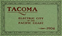
Tacoma: Electric City of the Pacific Coast, 1904
Language: en458 downloads on Project Gutenberg
Subjects
In: History - Other·History - American·History - Modern (1750+)
Public-domain ebook sourced from Project Gutenberg #64395.
Public-domain ebook
Language: en458 downloads on Project Gutenberg
Subjects
In: History - Other·History - American·History - Modern (1750+)
Public-domain ebook sourced from Project Gutenberg #64395.
The opening · free to read
Tacoma, the Electric City of the Pacific Coast, and the chief seaport of the North Pacific, is situated at the head of ocean navigation on Puget Sound in latitude 47° 15´ north and longitude 122° 25´ west from Greenwich. Being further north than Duluth or Quebec, Tacoma is supposed by many to be bleak and cold. A popular misapprehension among Eastern people seems to be that Puget Sound is somewhere near Alaska and that for half of the year the people contend with snow and ice.
CLIMATE AND HEALTH.
The climate of the Pacific Slope west of the Cascade Mountains is tempered by the Pacific Ocean, the “Japan current” and the equable southwesterly winds. The climate resembles that of Western Europe rather than that of the American Continent east of the Rocky Mountains. Tacoma is four degrees further south than London, in about the same latitude as Nantes, the chief city of Brittany, near the mouth of the Loire. The climate of Puget Sound is warmer in winter and cooler in summer than that of Southern England, and is the most equable, salubrious and delightful to be found in the United States.
TACOMA’S winters are open, the grass is green and flowers bloom out of doors every month in the year. Last winter the temperature fell below the freezing point (32° above zero, Fahrenheit), on one day in November, six days in December, three days in January, five days in February and eight days in March. The minimum temperature on the coldest day in November was 28° above zero; in December, 29°; in January, 26°; in February, 23°; and in March, 29°. It would be more accurate to speak of the “winter” months as the “rainy season,” for one-half of the annual precipitation, which amounted to 45.11 inches in 1903, an amount slightly above the average rainfall, fell during the three months of January, November and December. TACOMA has little snow and no ice. Cyclones or furious winds, in this peculiarly sheltered region between the Olympics and the Cascades, are unknown.
TACOMA’S summer climate is equally free from extremes. The temperature rarely rises to 80° Fahrenheit on summer afternoons. In the summer of 1903, for example, the mercury rose to 80° on only three days in June, two days in July, once in August and once in September. The nights are always cool, the days bright and balmy. Thunder and lightning are exceedingly rare occurrences. Nowhere in the world is the climate more conducive to health, longevity, exhilaration of mind and body, and to the production of flowers, fruits, forests and crops in greater abundance and variety.
TACOMA is one of the healthiest cities in the world. The number of deaths during the last census year was 425, indicating an annual death rate of 11.3 per 1,000, which is fully one-third less than the average annual death rate for the United States, 17.4 per 1,000, and almost the lowest reported from any one of the registration cities of the country. Since 1900 the death rate at TACOMA has decreased. The total number of deaths for twelve months ending June 30, 1904, was 520. The population of the city has increased 60 per cent. since the last federal census was taken and the annual death rate does not now exceed 8.67 per 1,000. Tacoma may fairly claim to be the healthiest city in the world.
DISTINCTIVE CHARACTERISTICS.
TACOMA is the youngest of the maritime cities of the United States. It is situated on one of the finest harbors in the world. It is the leading seaport of Puget Sound, the gateway to the Orient and Alaska. It is second only to San Francisco on the Pacific Coast in the volume and value of its foreign commerce. It is the chief Pacific Coast port for steamship lines maintaining regular sailings between TACOMA and Japan, Asiatic Russia, China and Manila; between TACOMA and London, Liverpool and Glasgow by way of the Orient, Suez Canal and the Mediterranean, the longest regular steamship route in the world; and between TACOMA and Hamburg, the chief seaport of Continental Europe, by way of Mexican, Central and South American ports. TACOMA is in direct, regular steamship communication with Alaska, San Francisco, Honolulu and New York. TACOMA is the western headquarters and chief Pacific Coast terminal of the Northern Pacific railway and the headquarters and western terminal of the Tacoma Eastern railroad, the most important independent railway in the State and the tourist route to Paradise Valley and Mount Tacoma. TACOMA handles the largest railway freight traffic of any city in the Pacific Northwest. It is the center and operating point of a system of city, suburban, and interurban electric railways, with 135 miles of track. It is the chief emporium, manufacturing and distributing point for the leading staple products of the forests, farms, mines and waters of the State of Washington and Alaska, and the “Inland Empire,” the valleys of the Upper Columbia and Snake Rivers in Eastern Washington and Idaho, between the Cascade Range and the Rocky Mountains. It is the chief wheat exporting and flour milling city of the Pacific Coast. It is the first city of the Pacific Northwest in manufactures. It is the electric city of the Pacific Coast with natural power resources unequalled at any city in America except Niagara Falls. It is the “home City” of the North Pacific Coast, and possesses scenic attractions which evoked from Sir Henry Irving the declaration that TACOMA has the most beautiful situation and environment of all the cities he had visited in the world. It is an educational, literary, musical and social center, with several institutions of higher learning, a Public Library, a famous Museum, 800 acres of parks of surpassing beauty, broad streets, fine public and private buildings, theaters, hotels, churches, hospitals, charitable and benevolent institutions and a rapidly growing population of enterprising, prosperous and hospitable people.
TACOMA’S ORIGIN AND NAME.
TACOMA dates its birth from July 14, 1873. On that day the commissioners appointed to locate the Puget Sound terminal of the Northern Pacific railway decided to recommend as such a point on the south side of Commencement Bay, in township twenty-one, range three east of the Willamette meridian. Commencement Bay was the largest and best sheltered harbor to be found on Puget Sound and was accessible by easy grades for railways from the north, south and east, and by several easy passes over the great Cascade Mountain range. Into the bay flows the Puyallup River, fed by the eternal glaciers of Mount Tacoma, the giant dome of snow whose image Theodore Winthrop found “displaced in the blue depths of tranquil waters” in the bay. The shore line of the bay, stretching ten miles from Brown’s Point at the northeast to Point Defiance at the northwest was at the time referred to unbroken by human habitations, save a hamlet clustering about a saw mill on the west shore of the bay, a view of which, from a photograph taken in 1871, is presented on the opposite page. In 1870 the federal census enumerator had found seventy-three inhabitants at TACOMA.
1—City and Mount Tacoma from Harbor. 2—Looking South from City Hall Tower. 3—Manufacturing District East of City Waterway. 4—Tacoma from McKinley Park. ]
In the Ferry Museum is the original plat or sub-division of some lands near the saw mill. It is entitled a map of lots at “Commencement City,” but a line is drawn through this name and the word “TACOMA” substituted. The owners of the land discussed the name “Commencement City” in the officers’ room of a Portland bank and rejected it as an awkward designation. They preferred instead the euphoneous Indian name of the mountain which rises majestically to a height of 14,526 feet southeast of the bay and commands the site of the city that was to be erected apparently at its very base. When President Roosevelt was Assistant Secretary of the Navy, he selected TACOMA as the name of a new cruiser, remarking that in his judgment the name should have been adopted as the name of the State, instead of Washington.
The selection of TACOMA in 1873 as the terminus of the Northern Pacific railway sealed its destiny as a great city. During the same year a section of the road was completed and opened extending from the north bank of the Columbia River at Kalama to TACOMA. The largest towns at that time in the Pacific Northwest were Portland and Victoria. The route between the two was by river steamer from Portland to Kalama, thence by rail to TACOMA, and thence by sound steamer to Victoria and intermediate points, Seattle being the largest town on the route. Fourteen years, however, elapsed before the main transcontinental line of the Northern Pacific crossed the Cascades and entered TACOMA from the east.
GROWTH IN POPULATION.
TACOMA’S population, according to the federal census, the annual school census, the directory lists, and other accepted bases of calculation, has increased as follows:
City City and Limits. Suburbs. 1870 73 1880 1,098 1900 37,714 42,311 1904 60,250 67,405
The figures for 1870, 1880 and 1900 above quoted are from the federal census. The number of names of individuals, exclusive of all names of firms, corporations, buildings and the like, in the city directory for 1900, published by R. L. Polk & Co., was 16,951. The district canvassed for the city directory includes the immediate suburbs, which are to all intents and purposes a part of the community. The ratio between the number of names in the directory of 1900 and the population of the city and immediate suburbs, as shown by the last federal census, was 1 to 2½. The number of names of individuals in the TACOMA city directory in 1900 and subsequent years with the population as indicated by the use of the multiplier 2½ is as follows:
Names in Estimated Year. City Directory. Population. 1900 16,951 *42,372 1901 20,418 51,045 1902 22,186 55,455 1903 25,057 62,642 1904 26,962 67,405
* Federal enumeration, 42,311.
1—Tacoma Hotel and Totem Pole. 2—Tacoma Theatre. 3—Northern Pacific Headquarters Building. 4—Tacoma Chamber of Commerce Building. ]
This estimate of population in 1904 is confirmed by the annual school census returns. The school census of 1904 for school district number 10, which is coextensive with the city limits, reports 13,389 children of school age residing in the district, as compared with 9,443 in 1900. The census of the districts contiguous to the city and embracing its immediate suburbs show a school population in 1904 of 1,426, as compared with 646 in 1900. The use of the multiplier 4½ applied to the school census returns, indicates a population within the city limits in 1904 of 60,250 and in the city and its immediate suburbs of 66,667. Other cities in the state employ a larger multiplier than 4½ to estimate population from their school census returns. For example, Seattle applies the multiplier 6½, and Spokane 5¾ to their school census returns in order to confirm their liberal estimates of population. TACOMA is content to employ a safe and conservative method of calculation.
Postoffice receipts more than confirm the foregoing estimates as to TACOMA’S growth and present population. The receipts of the TACOMA postoffice for the fiscal year ending June 30, 1904, were $113,599, as compared with $63,928 for the year ending June 30, 1900. The increase in postoffice receipts is at the rate of 14.7 per cent. in one year; 28.2 per cent. in two years; 53.7 per cent. in three years and 77.4 per cent. in four years. The increase in population as above shown by an increase of 10,011 in the number of names in the city directory is at the considerably lower rate of 59.0 per cent. in four years.
The book keeps going
Reading is free forever. Sign up and watch scenes appear while you read.



Scenes Storieta drew for other classics.
New illustrated classics
Once or twice a month: the latest books to get full character casts, scene art, and free comic editions. No account needed.